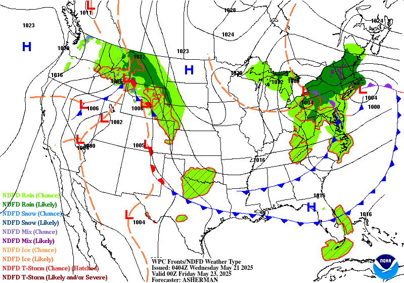
Extended Forecast Discussion
NWS Weather Prediction Center College Park MD
245 PM EDT Tue May 20 2025
Valid 12Z Fri May 23 2025 - 12Z Tue May 27 2025
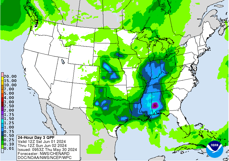
...Multi-day heavy rain threat in the Ozarks peaking this
weekend...
...Overview...
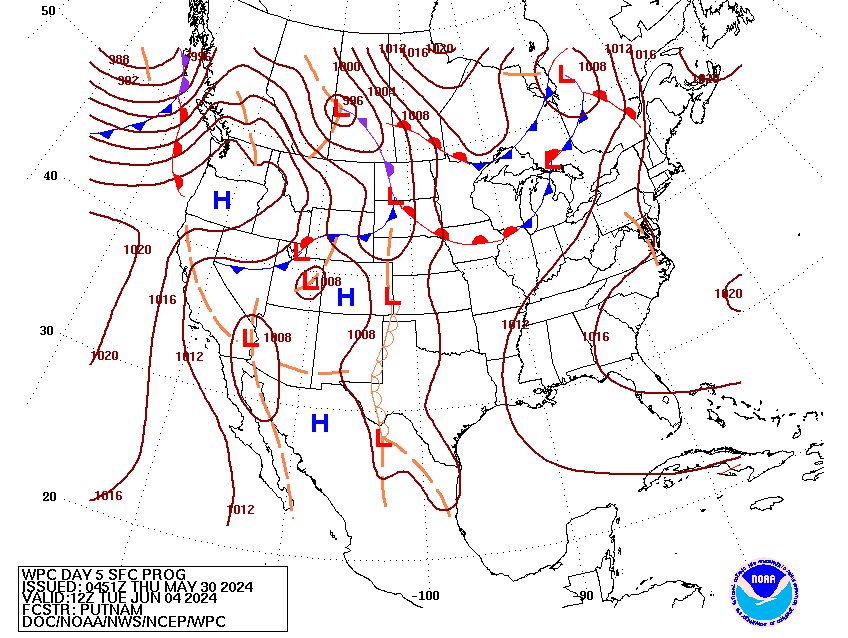
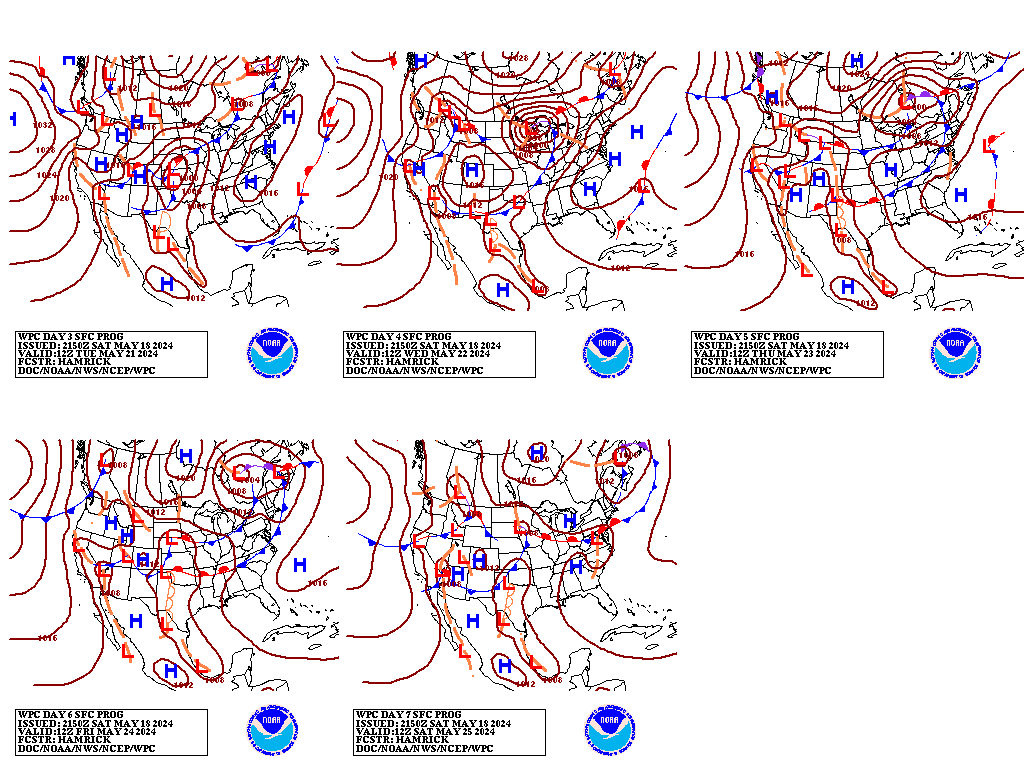
An omega-type pattern is forecast atop North America as the medium
range period begins Friday, as ridging amplifies in the central
U.S. while rounds of troughing move through the Northwest and an
upper low spins over the Great Lakes/Northeast. Cooler than average
temperatures should prevail under the eastern trough along with
some showers in the Northeast continuing Friday, while warmer than
average temperatures are likely underneath the ridge in the Four
Corners states to southern Plains and then over the Great Basin
early next week as the ridge rebuilds farther west. Frontal systems
emerging from the West toward the Plains and moist inflow ahead of
them will allow for increasing rain and thunderstorm chances in
the central U.S. from late week into the weekend. Multiple days of
heavy rain may occur focused in the Ozarks and vicinity and cause
flash flooding concerns.
...Guidance/Predictability Assessment...
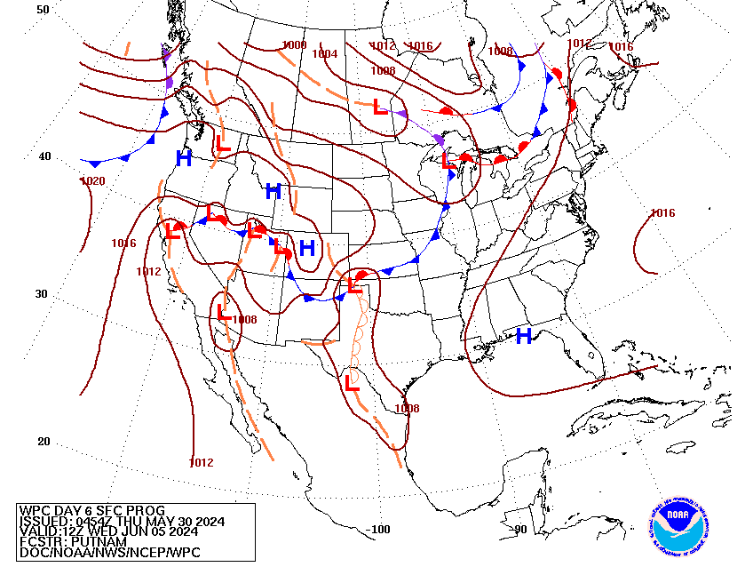
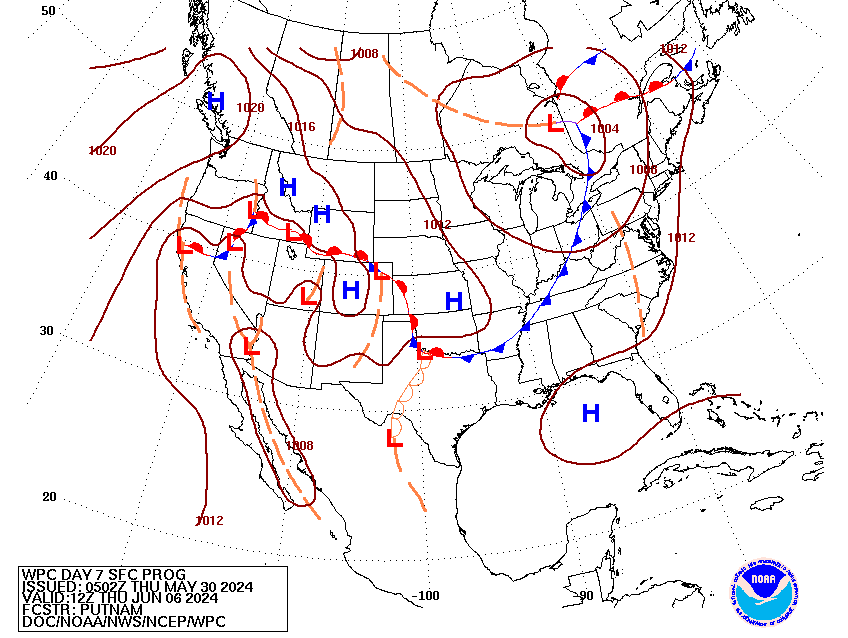
Model guidance remains in fairly good agreement with the depiction
of the large scale pattern through the medium range period,
particularly early on. The primary sources of uncertainty continue
to stem from the interaction of several shortwaves downstream of a
developing western ridge and upstream of a slow-to-breakdown,
pinwheeling upper low over the northeastern U.S this weekend into
next week. Fortunately, there has been some recent improvement
within the latest pieces of guidance, aside from the typical
uncertainties of smaller scale disturbances with shorter
wavelengths. The 00Z (and 12Z) UKMET was much more in line with
consensus with the evolution of the eastern trough this weekend and
therefore was able to be incorporated into the forecast blend
noted below. The CMC, which was not usable at 00Z, was much
improved at 12Z, no longer showing the large closed upper low
digging across the Pacific Northwest and the Upper Midwest this
weekend into early next week. Otherwise, the big picture being
advertised by the models remains the same, showing a large omega
block across North America breaking down through the weekend before
reloading and becoming re-established by the middle of next week.
The WPC forecast was based on a blend of the 06Z GFS, the 00Z
ECMWF and the 00Z UKMET, with the heaviest weighting placed on the
GFS/ECMWF solutions. Like the 12Z run, the 00Z CMC was also not
considered with this package given large differences from the
multi-model consensus. As the period progressed, included and
increased the proportion of the GEFS and EC ensemble means, with
the means making up half of the total blend by Day 7.
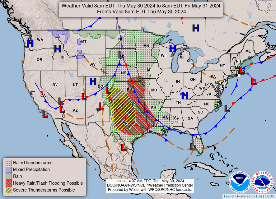
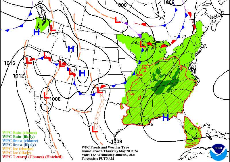
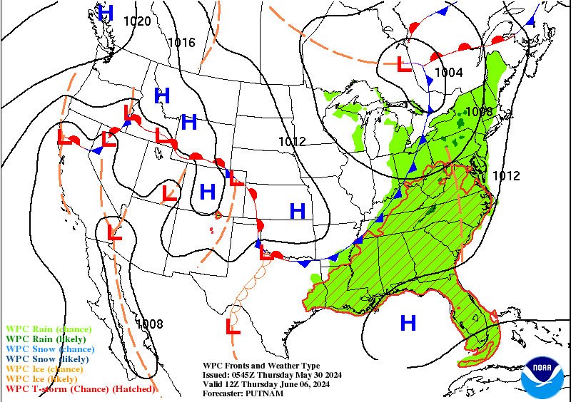
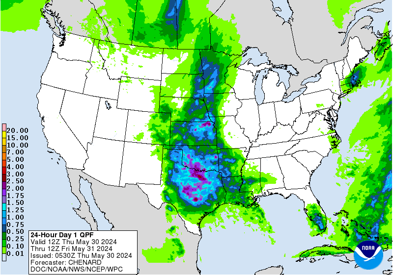
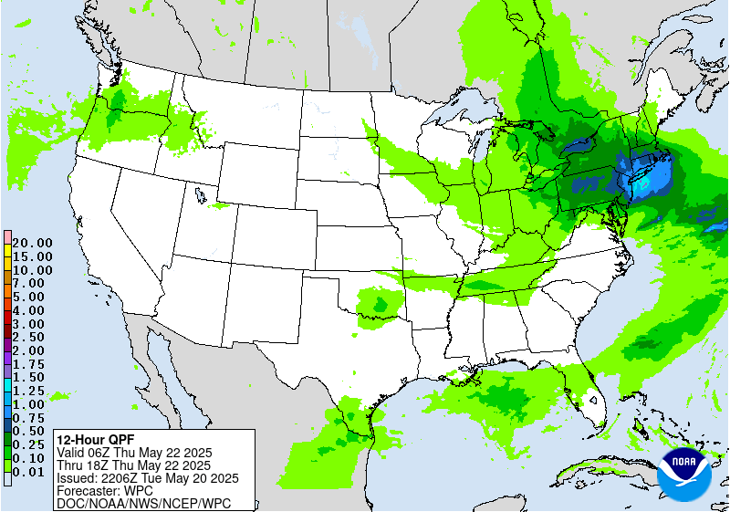
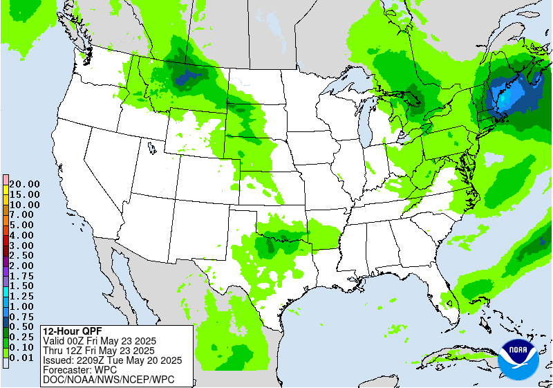
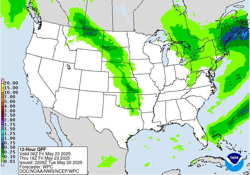
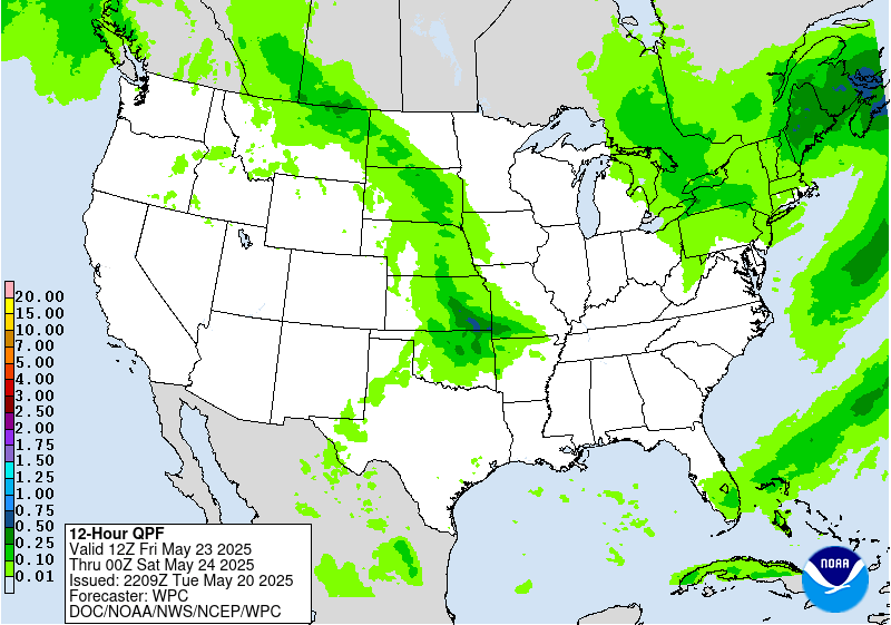
...Weather/Hazards Highlights...
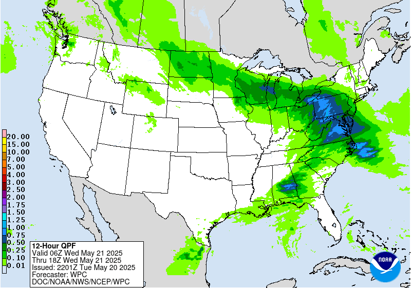
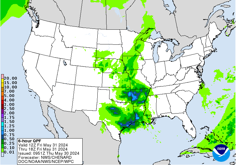
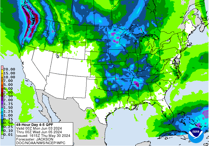
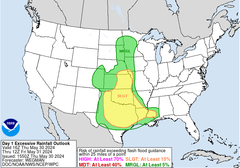
A prolonged heavy rainfall pattern over the central U.S. will set
up ahead of frontal systems on Friday with ample Gulf moisture
streaming north from return flow from high pressure over the
Southeast. This convection in the mean northwest flow should be
organized at times starting Friday afternoon over the south-central
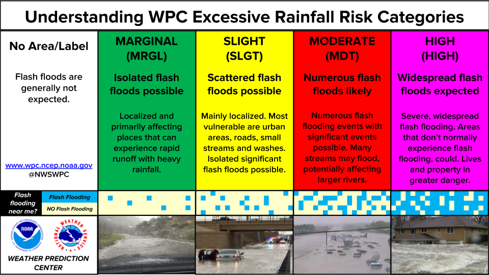
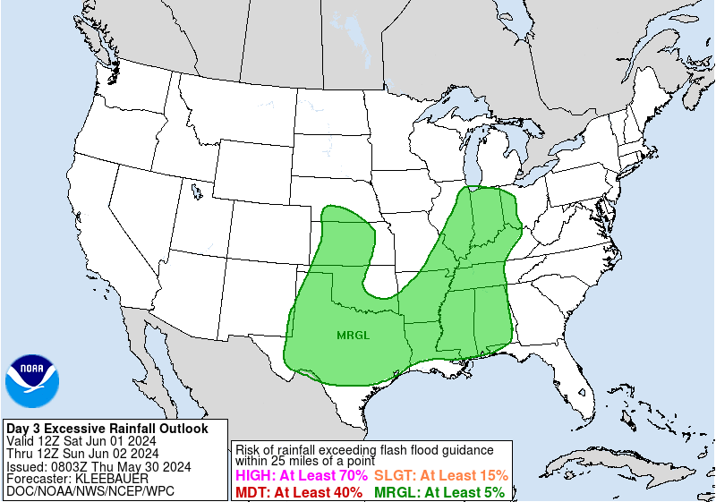
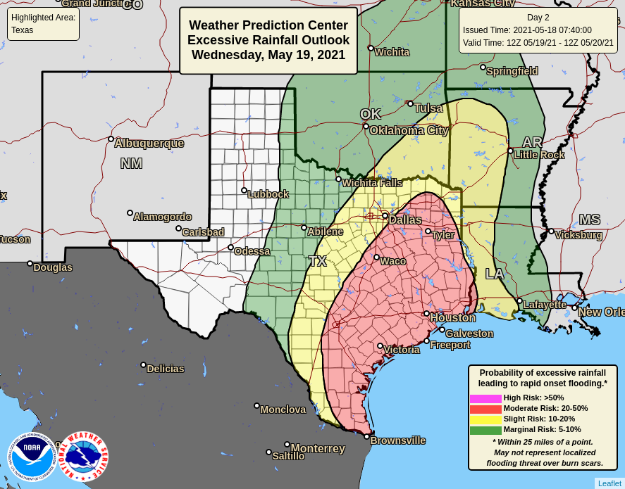
Plains to the Ozarks. A Marginal Risk remains in place for Day
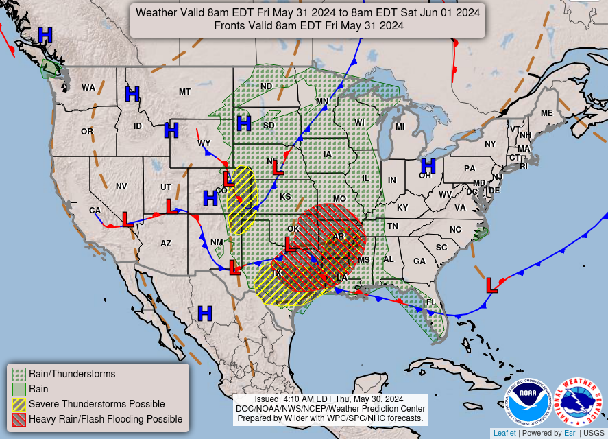
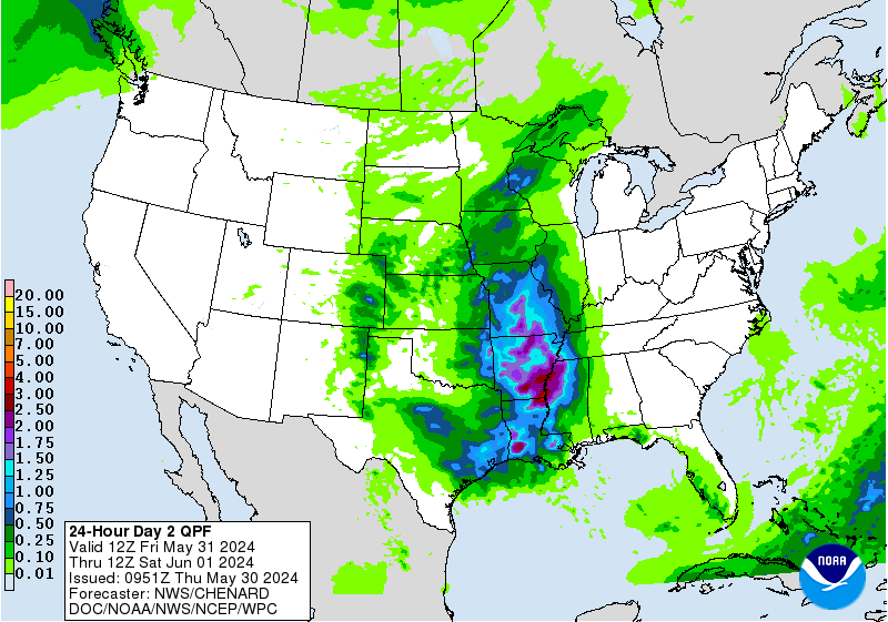
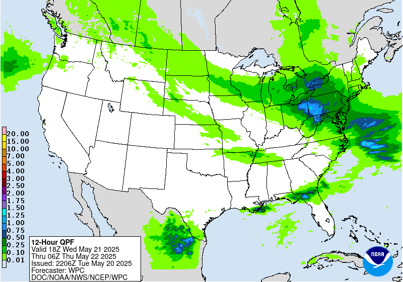
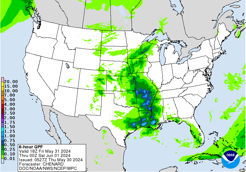
4/Friday in these areas. Then by Saturday, moisture and instability
are likely to further increase in these areas in response to a
shortwave coming into the north-central Rockies and High Plains.
Rain and storms are likely to overlap with Friday's convection
where there will be wetter antecedent conditions. A Slight Risk
remains centered over the Ozarks (which can be sensitive to flash
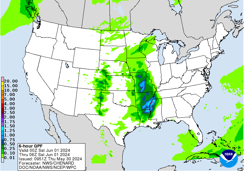
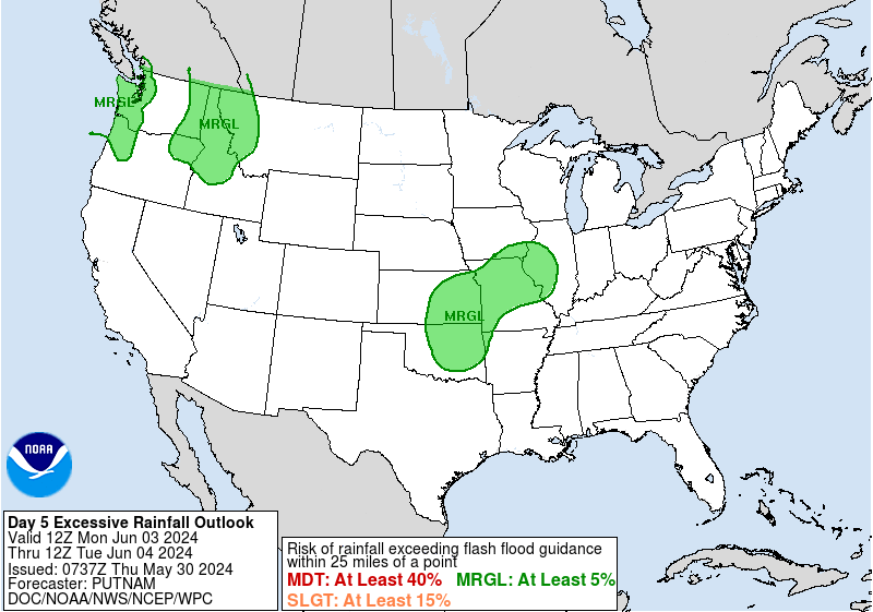
flooding anyway) for the Day 5/Saturday ERO. Yet another round of
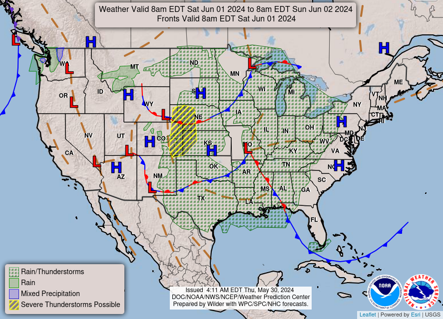
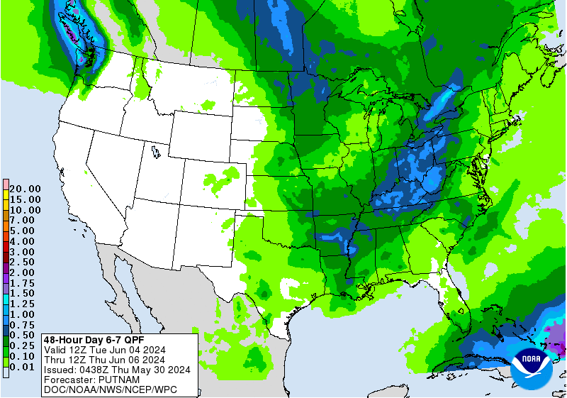
rain is expected Sunday in similar areas, before finally pressing
south Monday, though there is still uncertainty in positioning of
heavy rain by then.
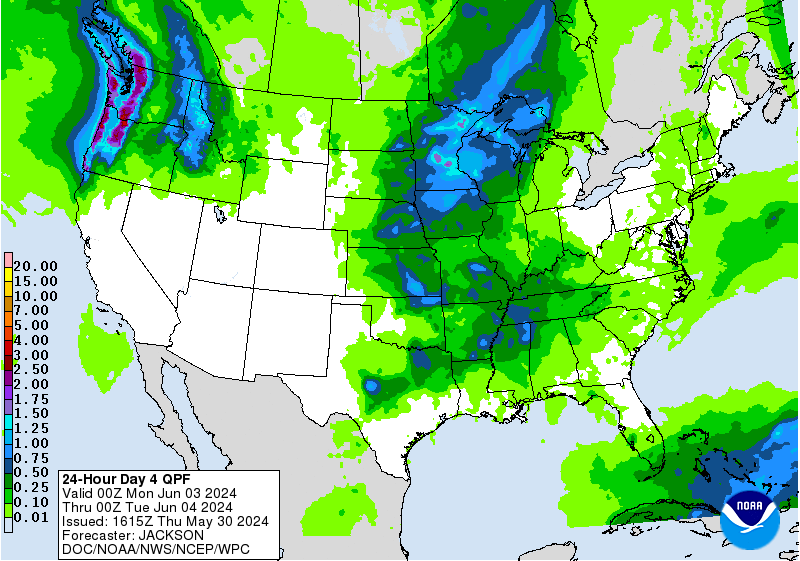
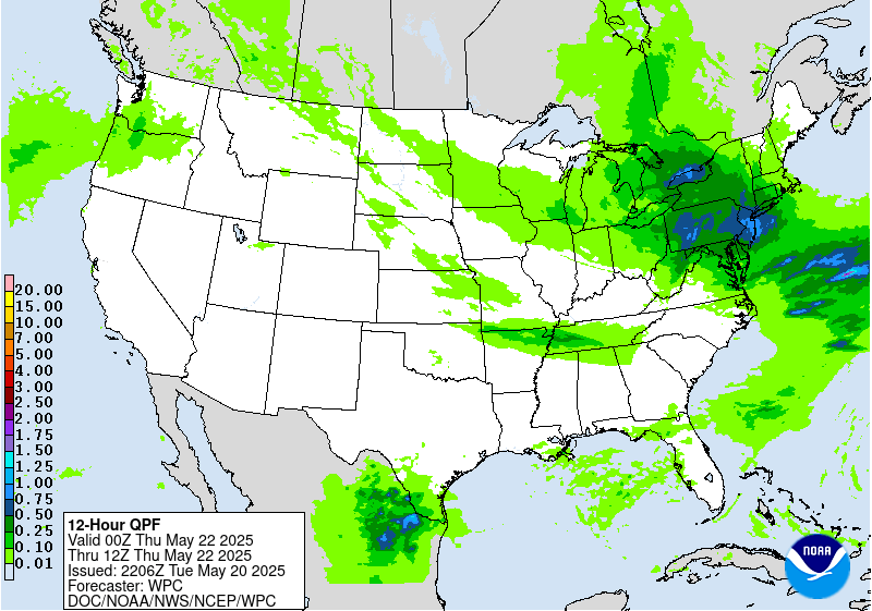
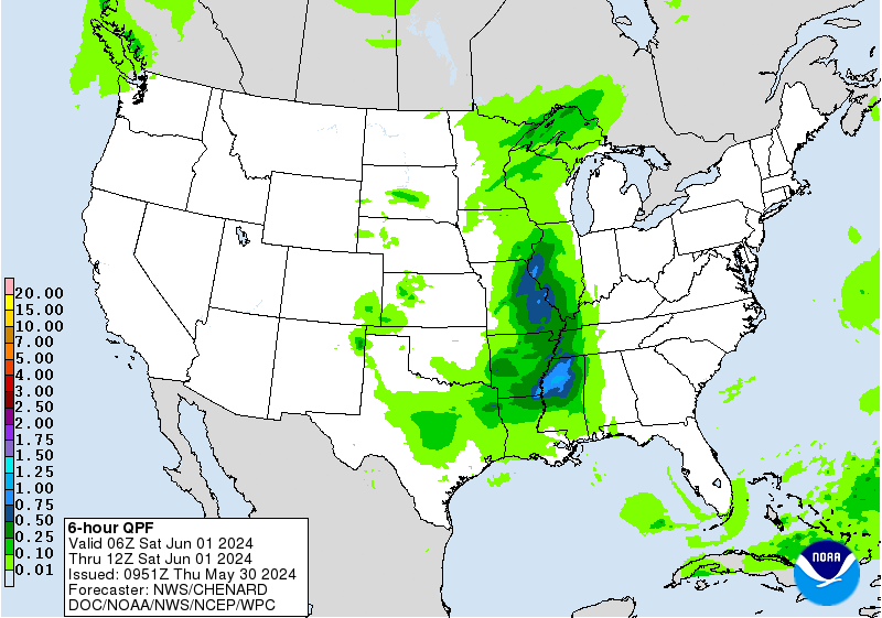
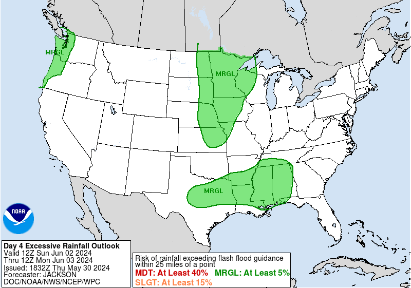
Precipitation, in the form of rain except for snow in the highest
peaks, is possible across the northwestern to north-central U.S.
Friday night/Saturday underneath upper troughing and as frontal
systems move through. The details are uncertain based on the model
spread with the supporting energies. But the shortwave providing
dynamical support, above normal PWs, and the cusp of the
instability gradient could provide some heavy rain and a low end
flash flood risk in the north-central High Plains. A Marginal Risk
is in place there for the Day 5/Saturday ERO.
Elsewhere, showers with modest QPF could continue across the
Northeast Friday and gradually lessen in magnitude through the
weekend as the upper and surface lows are slow to pull away there.
Summertime scattered storms are likely across the Florida Peninsula
through the period. The Northwest may see renewed precipitation
chances early next week.
Warmer than normal temperatures will be in place from the
Southwest and Four Corners states into the southern Plains on
Friday underneath the upper ridge. Temperatures are forecast to
gradually moderate closer to normal into the weekend, aside from
Texas staying warm. Then as the mean upper ridge rebuilds farther
west, the Great Basin and northern/central Rockies can expect
temperatures generally around 10-15 degrees above average.
Meanwhile, cooler than normal temperatures will take hold over the
north-central to eastern U.S. late this week and into the weekend
underneath upper troughing. Highs of 10-20 degrees below average
will be common in the Appalachians to Northeast on Friday in
particular before slowly moderating as the upper low drifts
northeast.
Miller/Tate
Additional 3-7 Day Hazard information can be found on the WPC
medium range hazards outlook chart at:
https://www.wpc.ncep.noaa.gov/threats/threats.php
WPC medium range 500mb heights, surface systems, weather grids,
quantitative precipitation forecast (QPF), excessive rainfall
outlook (ERO), winter weather outlook (WWO) probabilities, heat
indices, and Key Messages can be accessed from:
https://www.wpc.ncep.noaa.gov/medr/5dayfcst500_wbg.gif
https://www.wpc.ncep.noaa.gov/medr/5dayfcst_wbg_conus.gif
https://www.wpc.ncep.noaa.gov/5km_grids/5km_gridsbody.html
https://www.wpc.ncep.noaa.gov/qpf/day4-7.shtml
https://www.wpc.ncep.noaa.gov/#page=ero
https://www.wpc.ncep.noaa.gov/wwd/pwpf_d47/pwpf_medr.php?day=4
https://www.wpc.ncep.noaa.gov/heat_index.shtml
https://www.wpc.ncep.noaa.gov/#page=ovw


